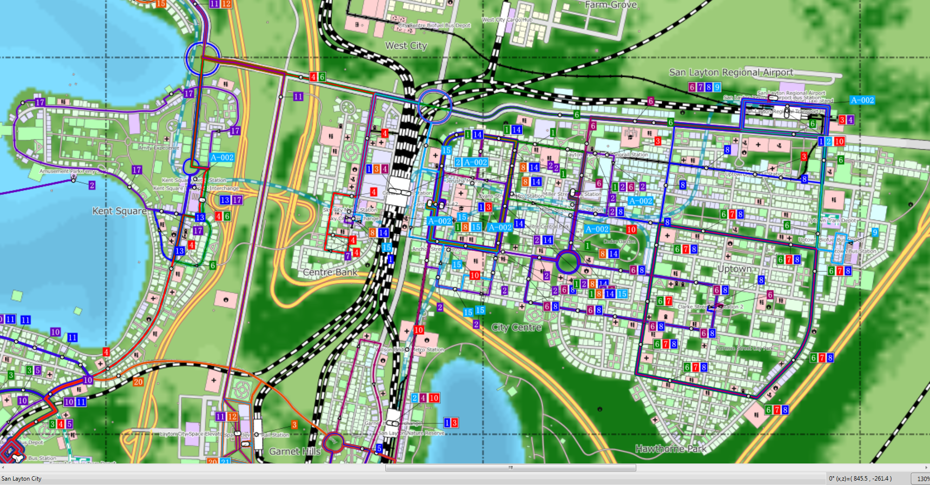
The New CSL Map Viewer has been excellent in not only showing the layout of my cities and the transport modes but also where I have holes in the transit system.
So guess what I will be doing? NEW BUS NETWORKS!!!!
How cool would your City be in 3D?
Yesterday while having family dinner in West Auckland I was pondering to myself I wonder what it would be like to have my Cities Skylines cities printed in 3D?
While for a large City that might end up very expensive to do (especially if in HO Scale (1:87) or even N Scale (1:148)) although the educational benefits would be tremendous. I also thought what about in straight 2D maps? The Cimtographer has been broken for a while but I did find a new one this morning from Japan – the CSL Map View.
The CSL Map View in short takes a snap shot of your entire City region including topography and transit systems and turns it into a very easy to read map you might find in just about any decent city with decent Wayfinding (ironically Japan). With the options of transit stops…
View original post 458 more words
