Slow but methodical; continuing to lay the skeleton and arteries that will support the brand new city!
Infrastructure building can be rather dry, or wet, smelly, electrifying, soothing, enlightening, administrative or any other term you can think of. And certainly it might not make the most enthralling video in Cities Skylines but without infrastructure your city basically goes NO WHERE (unless we are going back to Medieval times).
So, lets cut the chatter and continue laying down the roads, some transit as they will act as focal points, AND even get some rural industries put into position to support the soon to be fledgling Waikato!
I will continue to finish off the road network “off screen” in preparation for laying down the rest of the infrastructure in Part 2.2. Once part 2.2 is done we get to Part 3, THOSE STANDARDISED ZONES. Now I could do a PhD’s worth of writing and videos just on the zones but I will spare everyone that one. Basically and effectively Part 3 through using the zones will cover how Spatial and Land Use Planning intersect in determining the final aspect spatial form of a urban and rural areas. Bearing in mind that the infrastructure will play a very heavy influence as well as:
Transport Affects Land Use
Land use Affects Transport
Both Affect the City User Experience
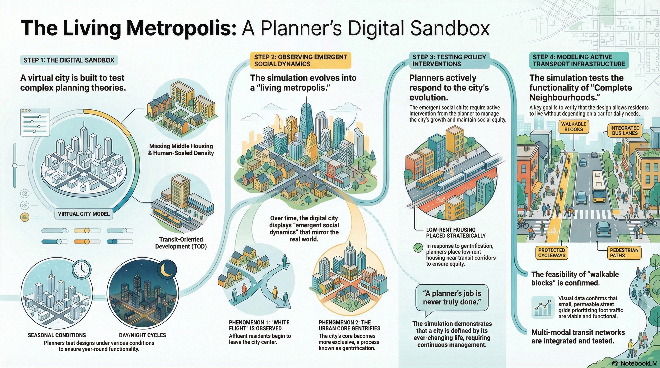
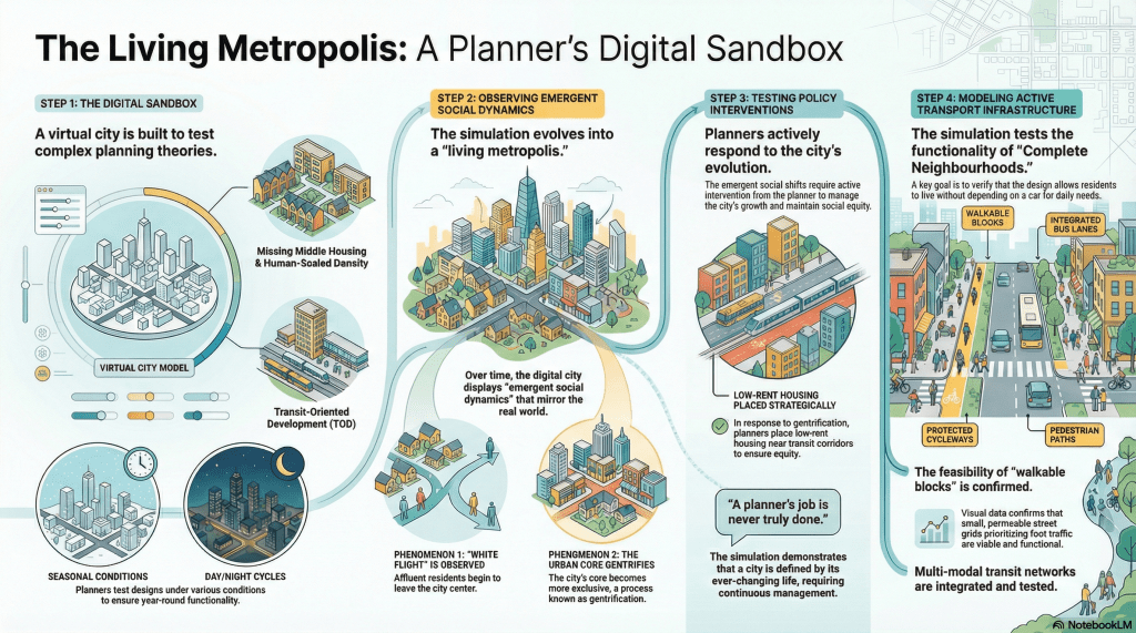
The infographic below gives a very high level overview as I start moving left to right as I continue put everything in place for Waikato before letting the first Cims and businesses move in (Part 4)
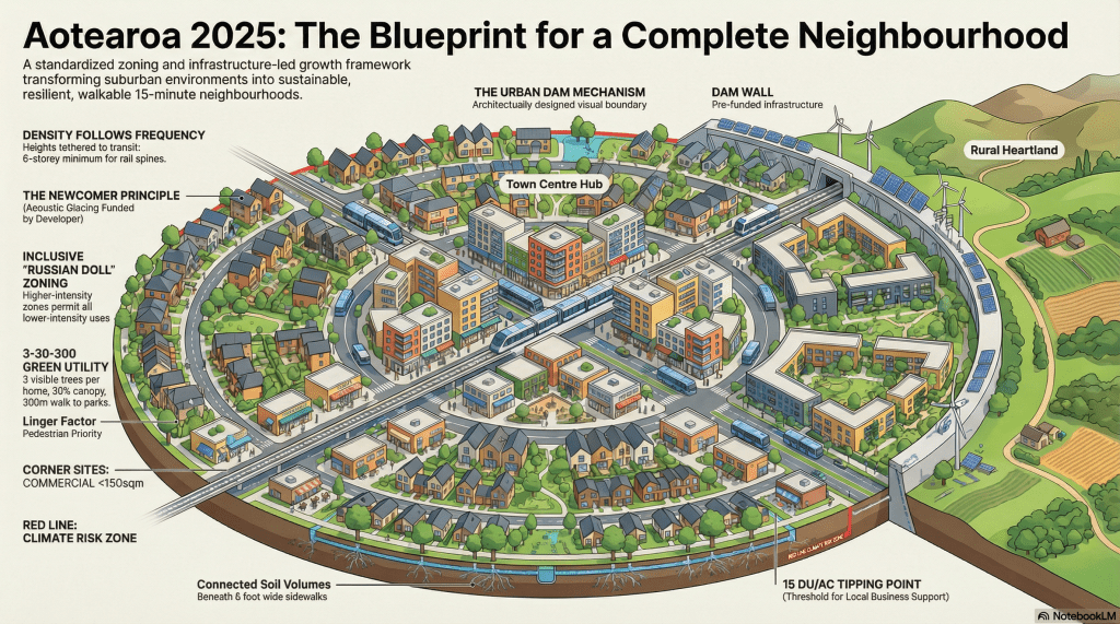
As for the overall spatial planning? If I was following my submission to the New Zealand Planning Bill then the infographic below gives an overview of the requirements I need to follow. We shall see how well this goes as Waikato’s story continues.