
How does Layton City look in Maps mode
Seeing your Cities Skyline cities as “photographs” is one thing, seeing your city in Google Maps mode is something else.
Periodically I will run the Cimotographier mod that generates the maps for Layton City – both as an overview and close-up renders.
The overview render is the “low resolution” shot that you can load on a phone (1200 x 900) while the close up is 12,000 x 9,000 and would recommend for desktops only.
The Maps of Layton City:
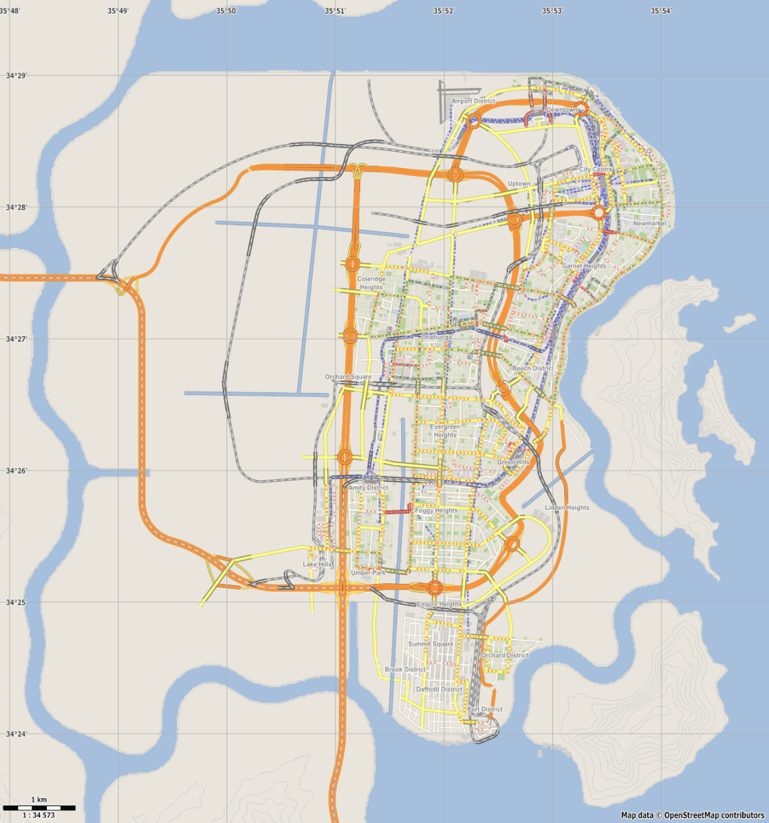

One thing missing from the maps is the cycle boulevards that run extensively in the City. The mod for the maps needs to be updated to reflect the boulevards and where they are placed. Otherwise you would be able to see the extensive cycle network system in Layton City.
Photos of Layton City

Central Station.

Layton Stadium


More drive through photos later.

One thought on “Layton City Map Renderings Ctd”
Comments are closed.