Part Four – Moving Through the New Urban Form
In Lessons for Auckland Ctd – Proof is in the Pudding: From Motorway to a Place People Love. #CitiesSkylines we see how the urban form established itself from what was a motorway to a new urban area mixed with residential and commerce.
The question is how to move everyone around this new area and how do we connect it to the existing urban area and its transit networks.
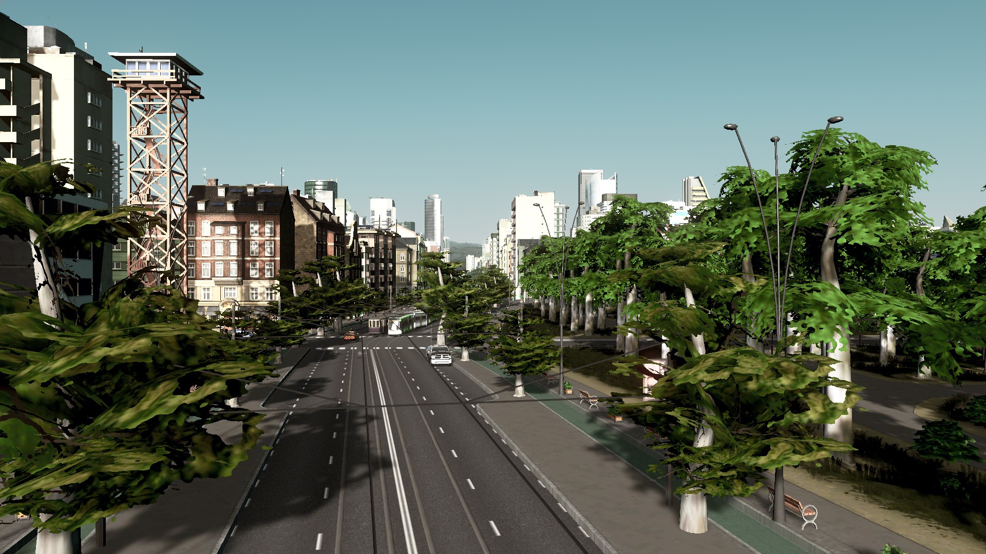
It would be a waste to fill the area up with cars and have those cars ruin the ambience of the area. Grade separated cycling lanes are available for shorter distance and I didn’t exactly wanted to put smelly diesel busses down the area either. Enter the trams or light rail system.

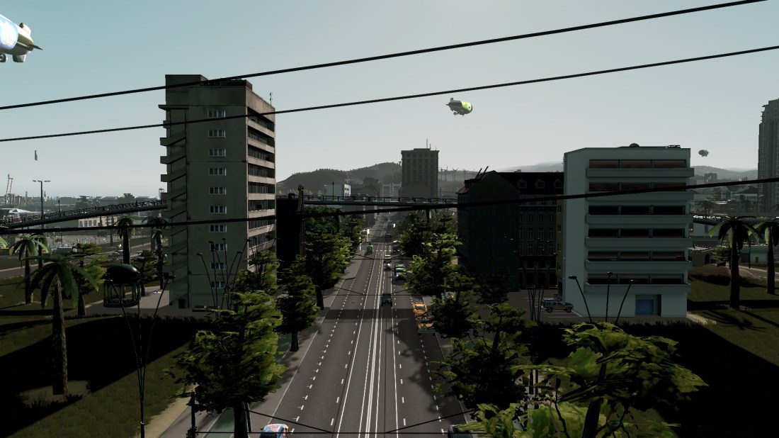
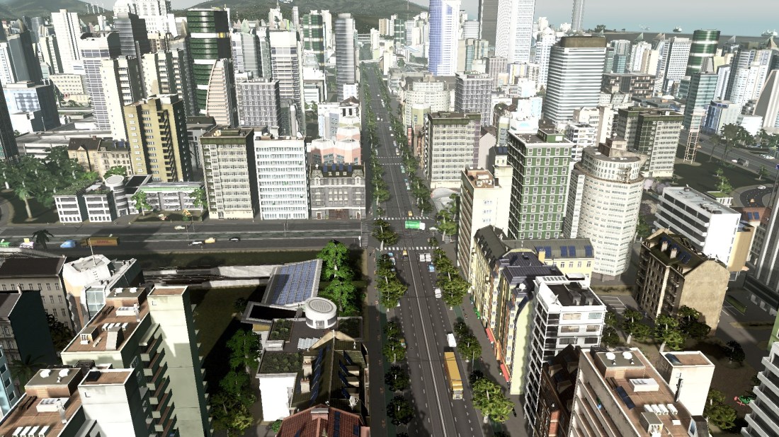
Four new tram lines were built with two connecting to the wider city and two travelling within the area forming a City Link type circuit. The photos below are of City Boulevard Lines 1 and two that run as a loop down the new Boulevard and through Forrest Road (one of the two east-west parallel roads). The other two lines that were later built are:
- City Centre to Airport LRT Line. Think of it as Solaria’s City Centre to Airport via Dominion Road, Auckland equivalent with the Airport-Solarian Line (a metro/subway line) as the express Southern Airport Line).
- Thorton Hills Interchange – City Boulevard Line. This links up the new urban area to a major interchange that serves busses and an inter-city train station
Lessons for Auckland?
Do not be afraid of Light Rail and also Light Rail is good for small intra suburb running as well as big trans-city running like Airport Lines.
Two of the four new tram lines are intra-suburb running – meaning the line runs within a single district rather than multiple districts. I can control individual line budgets meaning I can select capacity ranges from 75 to 210 passengers. As a comparison a bio-fuel bus holds 40 passengers while the bendy busses hold 130 and let off a pile of diesel fumes along the way. So rather clogging my nice new urban area up with smelly busses I can use smaller trams to move passengers around while stepping up capacity as demand increases.
Manukau City Centre and Manukau/Wiri would be a perfect example of such a Light Rail scheme that connects into a larger LRT scheme like the Southern Airport Line (Manukau to the Airport via Puhinui Station) or in Cities Skylines the two City Boulevard Lines connecting into the bigger trans-city lines.
The two bigger lines being the Thorton Interchange to City Centre Line and the Airport to City Centre LRT Line both which run through part of the City Boulevard Lines.
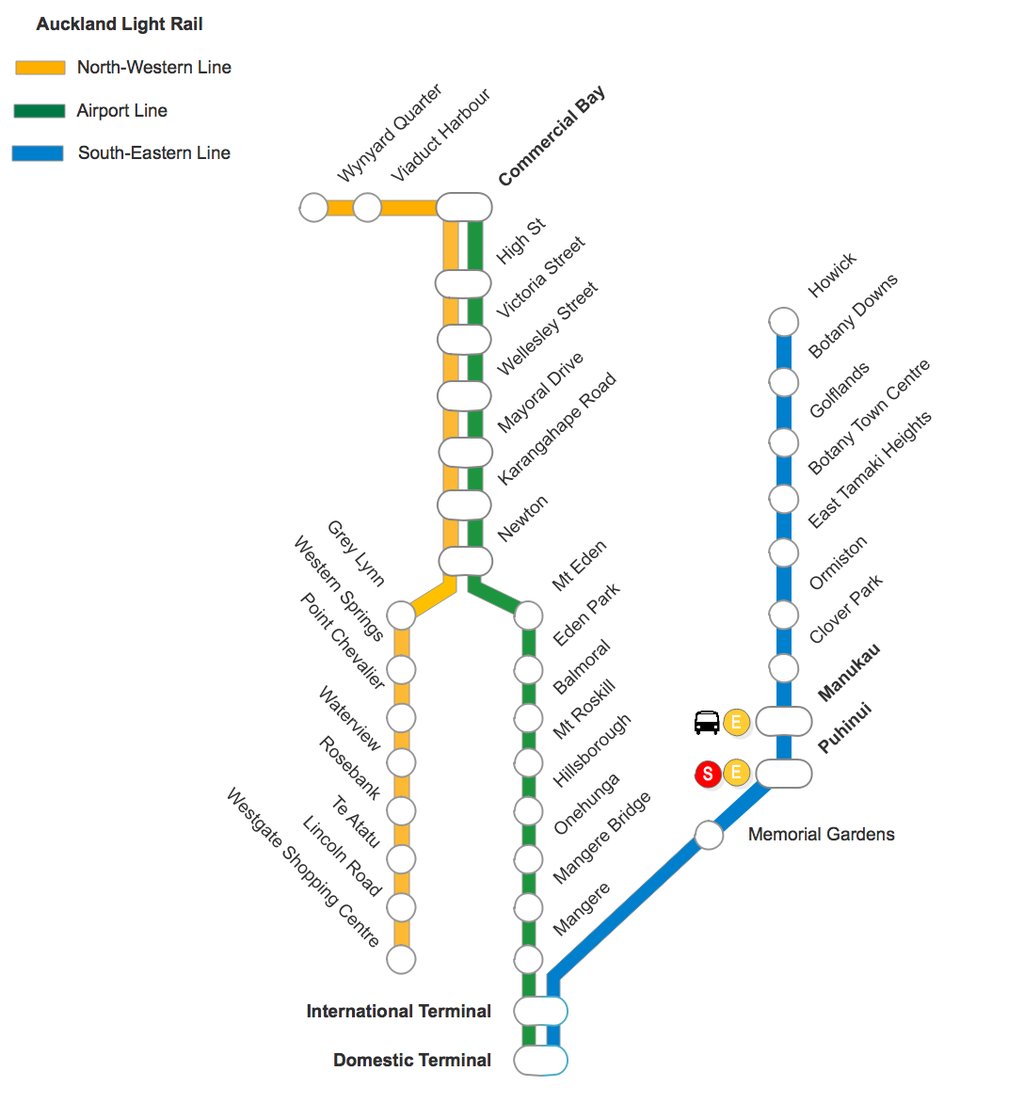
In this case these two bigger lines run through multiple districts and centres so using the big E-class tram that holds 210 passengers will be more viable (remember my biggest bus is only 130 passengers).
In the end there is no point building a nice new urban area for it only to be throttled by busses and cars. Local and inter-district routes need careful mapping out and in this case the trams were the ones that cut the mustard rather than the bus.
Also who would want their new government, shopping and residential district backed up with cars? No thanks!


Very interesting entry. The city I live in (Dallas, Texas) is very spread out and car-centered. Yet the light rail system has proven to be very popular. By using a bicycle and the rail line together (the rail cars come in units of three, with the center car set up for bikes and wheelchairs) I have cut my driving by three quarters.
Thanks for sharing.
LikeLike